auf Deutsch
en Francais
en Español
What can the app do?
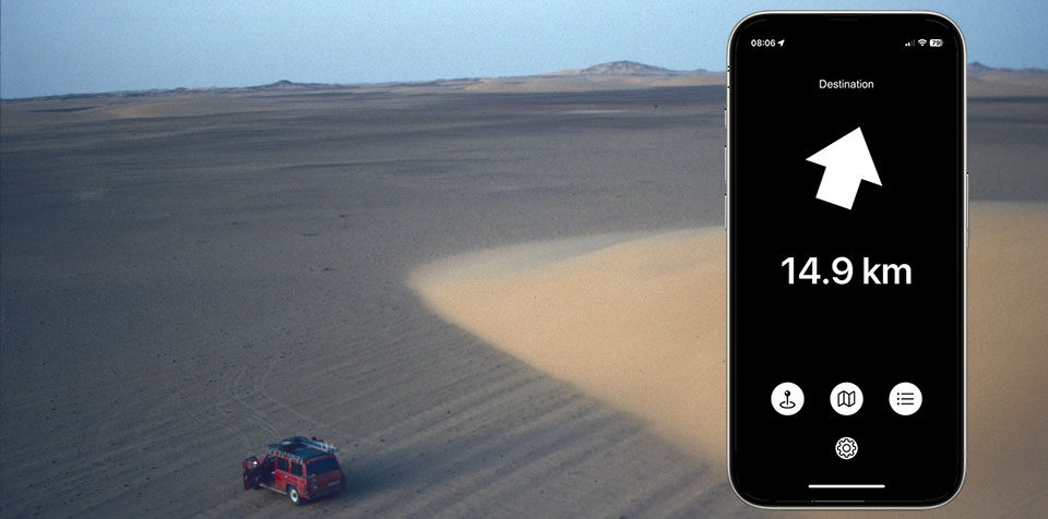
ArrowToWaypoint shows you the direction and distance to a waypoint you define. Anytime and anywhere – without a map and without internet access.
The waypoint can be any location you want to reach – for example, your current position you want to return to later.
What is a waypoint?
A waypoint is a location precisely described by GPS coordinates.
Your iPhone or iPad can determine its own position via satellite data.
ArrowToWaypoint calculates the direction and distance to the selected target.
You can save multiple waypoints in advance and navigate to them one after another.
How do I find GPS coordinates of a waypoint?
You can use the integrated Apple Map to search and mark a position. This can then be used for display or saved as a waypoint.
You may also use other map apps – we recommend Google Maps or Maps.Me.
Google Maps requires internet, while Maps.Me can be used offline.
How to find coordinates:
- Find the desired place on the map
- Tap and hold to set a marker
- The GPS coordinates appear at the bottom
- Two numbers separated by a comma, using a dot as decimal (e.g.
"45.67890, 12.34567")
You can copy and paste these into ArrowToWaypoint.
⚠️ Note: In Google Maps, coordinates are only shown for user-placed markers.
How do I save or delete waypoints?
- Tap the plus icon (+) at top right
- Enter a name and paste the copied GPS coordinates
- To delete: swipe left → tap Delete
- Tap a waypoint to activate it for display on the main screen
Is there an Android version?
I only develop for iOS. ArrowToWaypoint is available for Apple iPhone only.
Why is ArrowToWaypoint free?
I personally benefit from many free tools online. I'm grateful – and want to give something back.
My request: If you enjoy ArrowToWaypoint and use it regularly, please consider donating $10 or more annually to the UN Refugee Agency (UNHCR).
